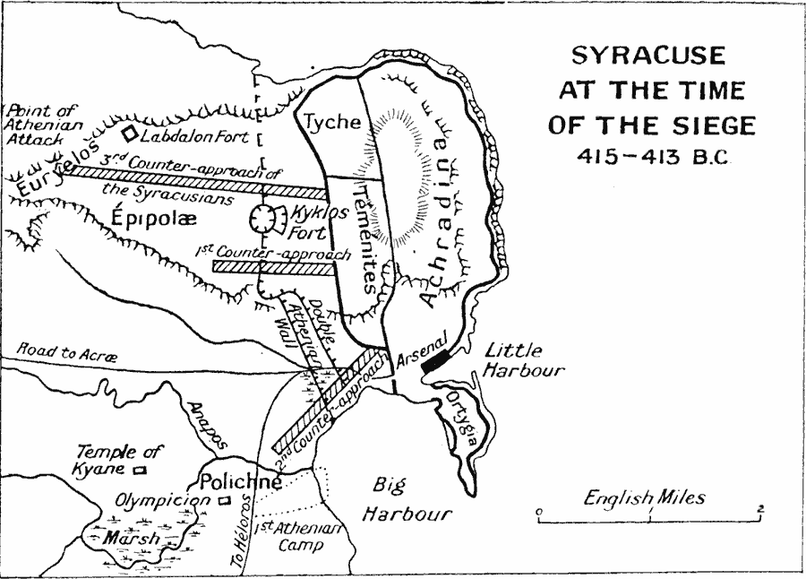
Description: A map of the Greek city–state of Syracuse at the time of the siege by Athens during the Peloponnesian War (415–413 B.C.). While most of Sicily and southern Italy was under Athenian control, Syracuse was aligned with the Spartans. This map shows the city walls around the old quarters of Achradina and the new quarters of Tyche and Temenites, fortifications and Kyklos (circle) Fort, the terrain, including the cliffs above the city where the Athenians built their Labdalon Fort, harbors, marshes, and rivers, as well as the roads to Acræ and Héloros. The map also shows the Athenian and Syracusian walls (circumvallations), and the Temple of Kyane and Olympicon (temple of Zeus).
Place Names: Italy, Anthradina, �Epipolae, �Greece, �Syracuse, �Temenites, �Tych
ISO Topic Categories: inlandWaters,
location,
oceans
Keywords: Syracuse at the Time of the Siege, battle, �historical, �military, kAncientGreece, historical event,
other military, inlandWaters,
location,
oceans, Unknown, 415–413 BC
Source: J.G. Bartholomew, LLD, A Literary & Historical Atlas of Europe (New York, New York: E.P. Dutton & Co., Ltd. , 1910) 114
Map Credit: Courtesy the private collection of Roy Winkelman |
|