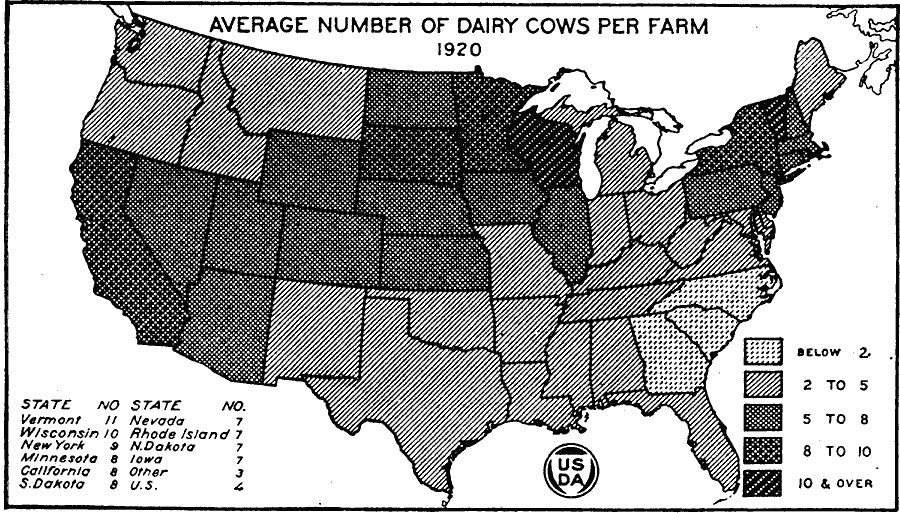
Description: A map of the United States from the U. S. Department of Agriculture (1922) showing the average number of dairy cows per farm by state in 1920.
Place Names: Agriculture, Vermont, Wisconsin, New York, Minnesota, California, South Dakota, Nevada, Rhode Island, North Dakota, Iowa, �cattl
ISO Topic Categories: farming,
boundaries,
inlandWaters
Keywords: Average Number of Dairy Cows per Farm, physical, �political, �statistical, �average number of dairy cows per farm by state in 1920, dairy cattle, kAgriculture, physical features, country borders,
major political subdivisions, agriculture, farming,
boundaries,
inlandWaters, Unknown, 1920
Source: , United States Department of Agriculture Yearbook 1922 (Washington, DC: Government Printing Office, 1923) 317
Map Credit: Courtesy the private collection of Roy Winkelman |
|