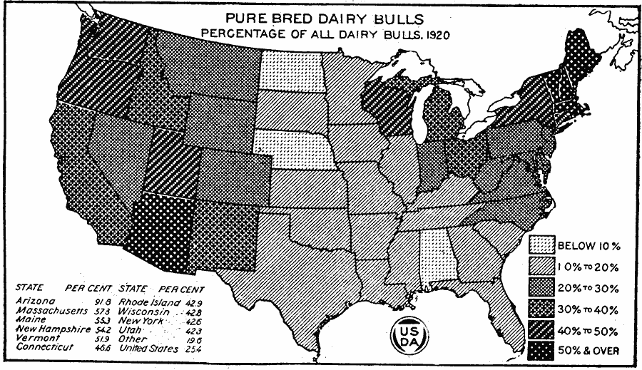
Description: A map of the United States from the U. S. Department of Agriculture (1922) showing the percentage of bulls per state that were pure bred dairy bulls in 1920.
Place Names: Agriculture, Arizona, Massachusetts, Maine, New Hampshire, Vermont, Connecticut, Rhode Island, Wisconsin, New York, Utah, �cattl
ISO Topic Categories: farming,
boundaries,
inlandWaters,
oceans
Keywords: Pure Bred Dairy Bulls, physical, �political, �statistical, �pure bred dairy bulls as a percentage of all dairy bulls in 1920 with percent by state, kAgriculture, physical features, country borders,
major political subdivisions, agriculture, farming,
boundaries,
inlandWaters,
oceans, Unknown, 1920
Source: , United States Department of Agriculture Yearbook 1922 (Washington, DC: Government Printing Office, 1923) 325
Map Credit: Courtesy the private collection of Roy Winkelman |
|