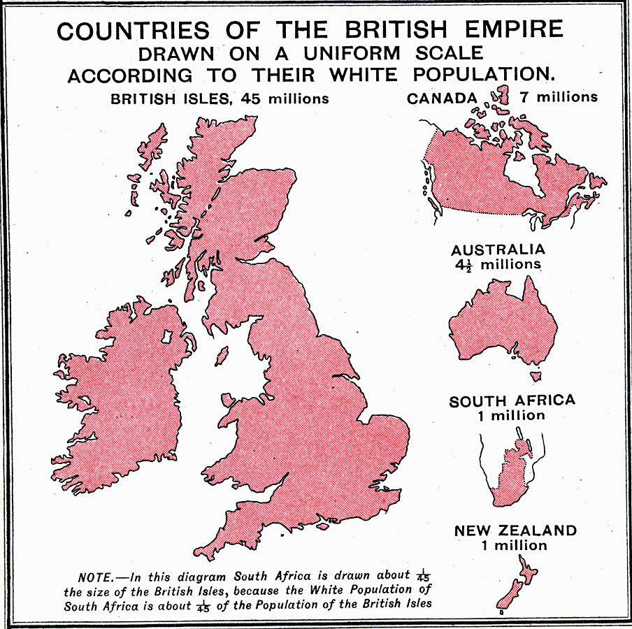
Description: A map from 1915, showing countries of the British Empire, drawn to a uniform scale according to their white population. The map shows the white population in 1915 for the British Isles: 45 millions, Canada: 7 millions, Australia: 4.5 millions, South Africa: 1 million, and New Zealand: 1 million. "In this diagram South Africa is drawn about 1/45 the size of the British Isles, because the White Population of South Africa is about 1/45 of the Population of the British Isles."
Place Names: United Kingdom, Europe, �North America, �Africa, �South Africa, �Canada, �New Zealand, �British Isles, �Australi
ISO Topic Categories: inlandWaters,
oceans,
location,
boundaries,
society
Keywords: Countries of the British Empire, physical, �political, �borders, �statistical, �population, �ethnological, �physical features, country borders, population,
ethnological, inlandWaters,
oceans,
location,
boundaries,
society, Unknown, 1915
Source: J.G. Bartholomew, A School Economic Atlas (London, England: Oxford University Press, 1915) 16
Map Credit: Courtesy the private collection of Roy Winkelman |
|