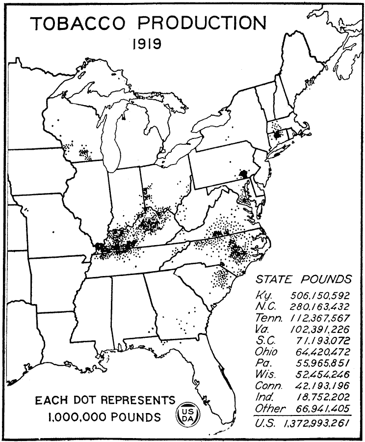
Description: A map of the United States from the U. S. Department of Agriculture (1922) showing centers of production of tobacco in the United States in 1919.
Place Names: Agriculture, Kentucky, �North Carolina, �Tennessee, �Virginia, �South Carolina, �Ohio, �Pennsylvania, �Wisconsin, �Connecticut,�Indiana, �tobacc
ISO Topic Categories: boundaries,
oceans,
farming,
inlandWaters
Keywords: Tobacco Production, physical, �political, �statistical, �united states tobacco production location, production centers, tobacco farming areas, kAgriculture, physical features, major political subdivisions,
country borders, agriculture, boundaries,
oceans,
farming,
inlandWaters, Unknown, 1919
Source: , United States Department of Agriculture Yearbook 1922 (Washington, DC: Government Printing Office, 1923) 407
Map Credit: Courtesy the private collection of Roy Winkelman |
|