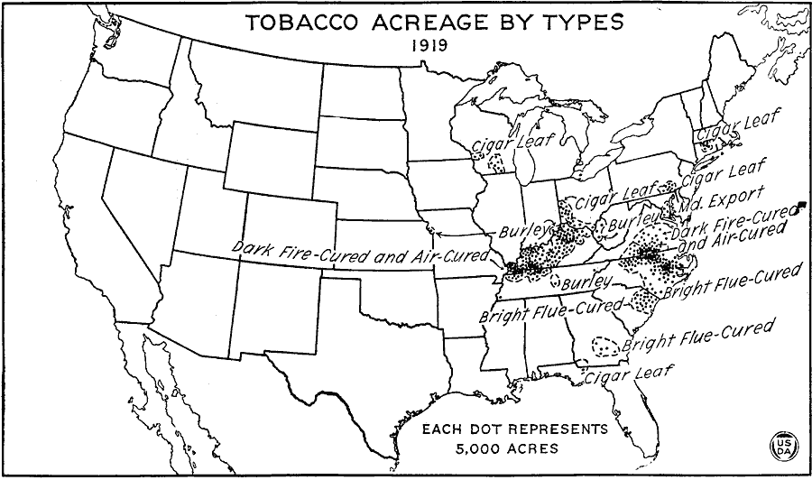
Description: A map of the eastern United States from the U. S. Department of Agriculture (1922) showing tobacco acreage subdivided by the type of tobacco raised and principal methods of curing the product in 1919. Each dot represents 5,000 acres in cultivation.
Place Names: Agriculture, tobacc
ISO Topic Categories: boundaries,
oceans,
farming,
inlandWaters
Keywords: Tobacco Acreage by Type, physical, �political, �statistical, �united states tobacco acreage by type of tobacco raised, dark fire-cured and air-cured, burley, cigar leaf, bright flue-cured, maryland export, kAgriculture, physical features, major political subdivisions,
country borders, agriculture, boundaries,
oceans,
farming,
inlandWaters, Unknown, 1919
Source: , United States Department of Agriculture Yearbook 1922 (Washington, DC: Government Printing Office, 1923) 410
Map Credit: Courtesy the private collection of Roy Winkelman |
|