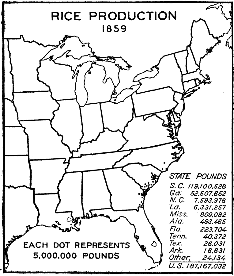
Description: A map of the eastern United States from the U. S. Department of Agriculture (1922) showing the average yield of rice production in 1859. Each dot represents 5,000,000 pounds. The total yield of rice for the United States in 1859 was 187,167,032 pounds.
Place Names: Agriculture, South Carolina, Georgia, North Carolina, Louisiana, Mississippi, Alabama, Florida, Tennessee, Texas, Arkansas, Ric
ISO Topic Categories: boundaries,
oceans,
farming,
inlandWaters
Keywords: Rice Production in the United States, physical, �political, �statistical, �united states rice production centers, rice farming areas, kAgriculture, physical features, major political subdivisions,
country borders, agriculture, boundaries,
oceans,
farming,
inlandWaters, Unknown, 1859
Source: , United States Department of Agriculture Yearbook 1922 (Washington, DC: Government Printing Office, 1923) 516
Map Credit: Courtesy the private collection of Roy Winkelman |
|