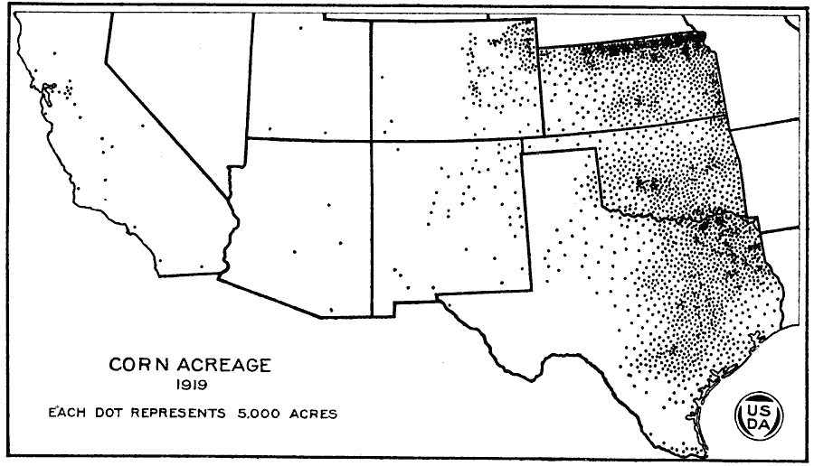
Description: A map of the western United States from the U. S. Department of Agriculture (1922) showing corn acreage in the Southwest region of the United States in 1919. Each dot represents 5,000 acres of corn production.
Place Names: Agriculture, Kansas, Oklahoma, Texas, Colorado, �cor
ISO Topic Categories: boundaries,
oceans,
farming
Keywords: Corn Acreage in the West, physical, �political, �statistical, �grain sorghum acreage in 1919 in the southwestern united states, kAgriculture, physical features, major political subdivisions,
country borders, agriculture, boundaries,
oceans,
farming, Unknown, 1919
Source: , United States Department of Agriculture Yearbook 1922 (Washington, DC: Government Printing Office, 1923) 526
Map Credit: Courtesy the private collection of Roy Winkelman |
|