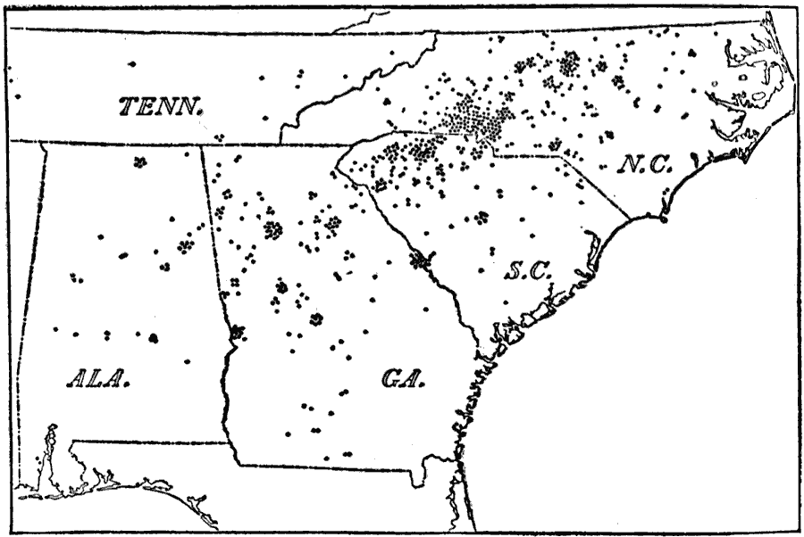
Description: A map from 1910 of the southeastern United States showing the extent of cotton manufacturing in the South at the time. Each dot represents one mill.
Place Names: Agriculture, Florida, �Georgia, �Alabama, �Tennessee, �South Carolina, �North Carolina, �cotto
ISO Topic Categories: location,
oceans,
boundaries,
economy
Keywords: Cotton Manufacturing in the South, physical, �statistical, �political, kAgriculture, kIndustry, physical features, major political subdivisions, industry, location,
oceans,
boundaries,
economy, Unknown, 1910
Source: Ralph S. Tarr, B.S., F.G.S.A. and Frank M. McMurry, Ph.D., New Geographies 2nd ed (New York, NY: The Macmillan Company, 1910) 82
Map Credit: Courtesy the private collection of Roy Winkelman |
|