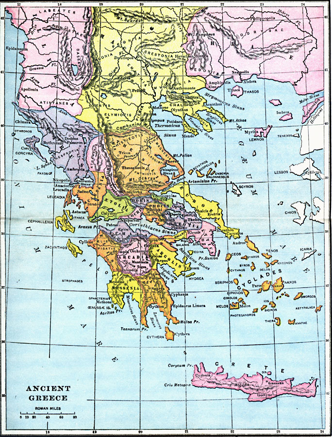
Description: A map of ancient Greece, showing the territories of Messenia, Laconia, Elis, Arcadia, Argolis, Achaia, Boeotia, Attica, Acarnania, &Aelig;tolia, Locris, Doris, Phocis, Euboea, Epirus, Athamania, Thessalia, the southern portions of Illyria, Macedonia, and Thrace, the islands of the Cyclades, Crete, Cephallenia, and Zacynthos.
Place Names: Greece, Arcadia, �Acarnania, �Argolis, �Athens, �Doris, �Epirus, �Etolia, �Illyria, �Macedon, �Messania, �Thessalonik
ISO Topic Categories: location
Keywords: Ancient Greece, county borders, �historical, �political, �water routes, ��county borders, location, Unknown, 1600–265 BC
Source: Victor Duruy, Edwin A. Grosvenor, & Louis E. Van Norman, Duruy's General History of the World (vol. I) (New York, New York: The Review of Reviews Company, 1912)
Map Credit: Courtesy the private collection of Roy Winkelman |
|