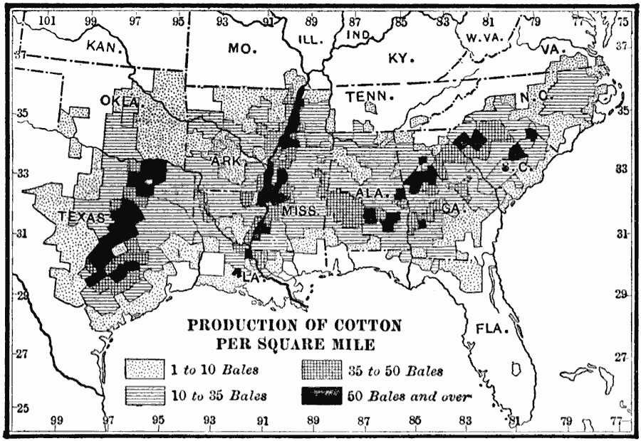
Description: A map from 1910 of the United States showing the principal cotton–producing regions of the country at the time. The map is coded to show areas of production of cotton per square miles ranging from 1 to 10 bales per square mile to 50 and over bales per square mile.
Place Names: Agriculture, cotto
ISO Topic Categories: boundaries,
inlandWaters,
location,
oceans,
farming
Keywords: Cotton Producing States, physical, �statistical, �political, kAgriculture, physical features, country borders,
major political subdivisions, agriculture, boundaries,
inlandWaters,
location,
oceans,
farming, Unknown, 1910
Source: Ralph S. Tarr, B.S., F.G.S.A. and Frank M. McMurry, Ph.D., New Geographies 2nd ed (New York, NY: The Macmillan Company, 1910) 184
Map Credit: Courtesy the private collection of Roy Winkelman |
|