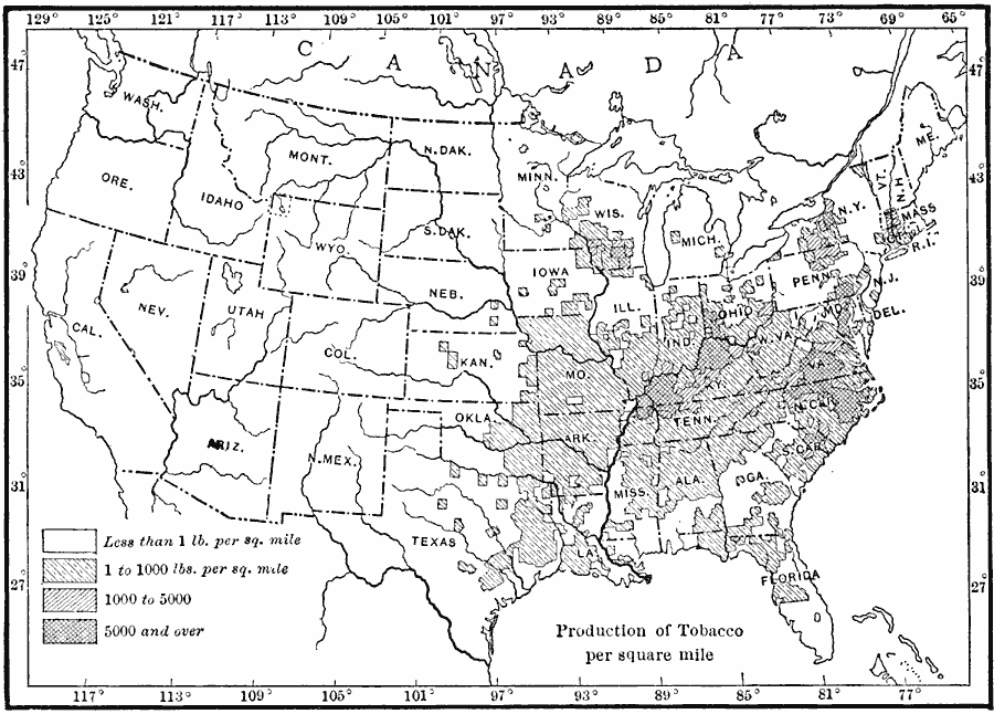
Description: A map from 1910 of the United States showing the tobacco producing regions at the time. The map is keyed to show areas of tobacco production ranging from less than 1 pound per square mile to 5,000 pounds and over.
Place Names: Agriculture, tobacc
ISO Topic Categories: boundaries,
location,
inlandWaters,
oceans,
farming
Keywords: Tobacco Production, physical, �political, �statistical, kAgriculture, physical features, country borders,
major political subdivisions, agriculture, boundaries,
location,
inlandWaters,
oceans,
farming, Unknown, 1910
Source: Ralph S. Tarr, B.S., F.G.S.A. and Frank M. McMurry, Ph.D., New Geographies 2nd ed (New York, NY: The Macmillan Company, 1910) 185
Map Credit: Courtesy the private collection of Roy Winkelman |
|