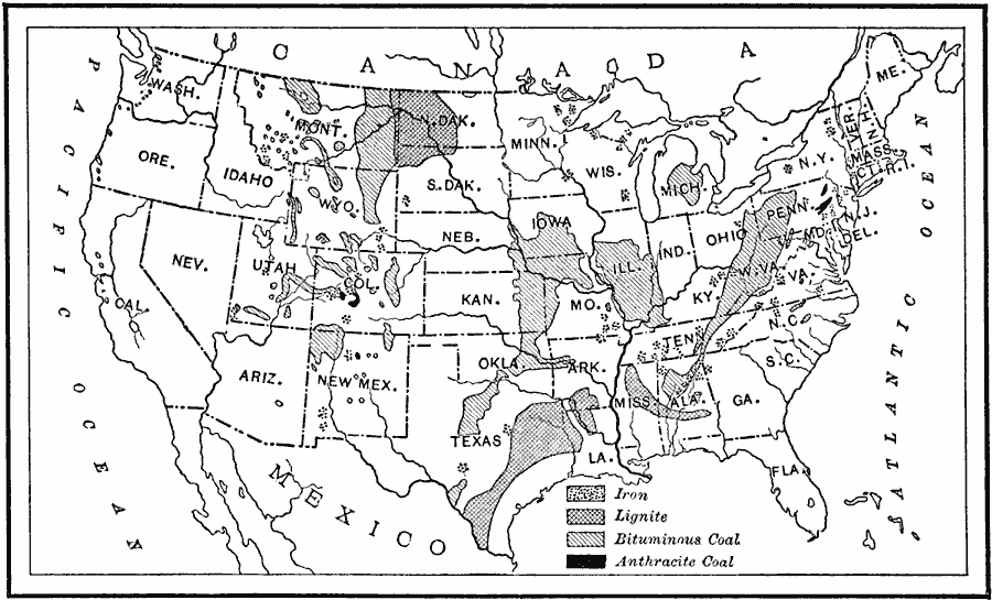
Description: A map from 1910 of the contiguous United States showing the regions of iron coal deposits. The map is keyed to show deposits of iron ore, lignite coal, bituminous coal, and anthracite coal in the region.
Place Names: Minerals, coal, �iron or
ISO Topic Categories: boundaries,
geoscientificInformation,
inlandWaters,
oceans,
location
Keywords: Coal and Iron Deposits in the United States, physical, �political, kResources, physical features,
geological, country borders,
major political subdivisions, boundaries,
geoscientificInformation,
inlandWaters,
oceans,
location, Unknown, 1910
Source: Ralph S. Tarr, B.S., F.G.S.A. and Frank M. McMurry, Ph.D., New Geographies 2nd ed (New York, NY: The Macmillan Company, 1910) 189
Map Credit: Courtesy the private collection of Roy Winkelman |
|