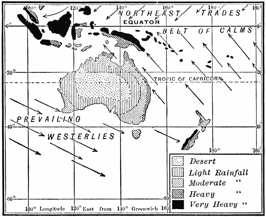
Description: A map from 1910 of Australasia showing prevailing wind direction and rainfall patterns in the region. The map shows the heavy rainfall on the east–facing coast of Australia where the trade winds blow. Notice also the arid interior and west coast. "Most of Australia is in the southeast trade wind belt. Therefore, rainfall is ample on the eastern coast; but since the highlands on this continent are close to the east coast, nearly all the remainder of the country suffers for want of rain. The southwestern tip of Australia, the island of Tasmania, and the southern island of New Zealand, like southern Chile, are reached by the prevailing westerlies; and for that reason they receive abundant rain." — Tarr and McMurry, 1910, p.212.
Place Names: A Complete Map of Australia, Australia, �New Zealand, �Papua New Guinea, �Indonesi
ISO Topic Categories: inlandWaters,
location,
oceans,
climatologyMeteorologyAtmosphere
Keywords: Rainfall and Wind in Oceania, physical, �meteorological, kClimate, physical features, winds,
rainfall, inlandWaters,
location,
oceans,
climatologyMeteorologyAtmosphere, Unknown, 1910
Source: Ralph S. Tarr, B.S., F.G.S.A. and Frank M. McMurry, Ph.D., New Geographies 2nd ed (New York, NY: The Macmillan Company, 1910) 212
Map Credit: Courtesy the private collection of Roy Winkelman |
|
