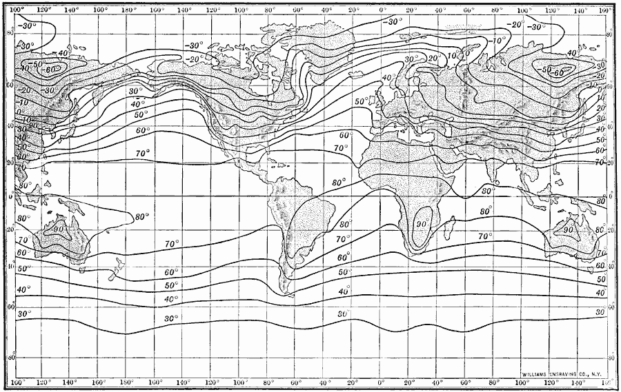
Description: An isothermal chart of the world from 1910 showing typical isotherm patterns for the month of January. "An isotherm is a line connecting places having the same average temperature. An isothermal chart is one showing these isotherms for a given area...a chart for January averages all the temperatures for that period."
Place Names: A Complete Map of Globes and Multi-continent, Africa, �Asia, �Australia, �Europe, �North America, �South Americ
ISO Topic Categories: climatologyMeteorologyAtmosphere,
location,
oceans
Keywords: Isothermal Chart of the World for January, physical, �meteorological, kClimate, physical features, temperature, climatologyMeteorologyAtmosphere,
location,
oceans, Unknown, 1910
Source: Ralph S. Tarr, B.S., F.G.S.A. and Frank M. McMurry, Ph.D., New Geographies 2nd ed (New York, NY: The Macmillan Company, 1910) 226
Map Credit: Courtesy the private collection of Roy Winkelman |
|