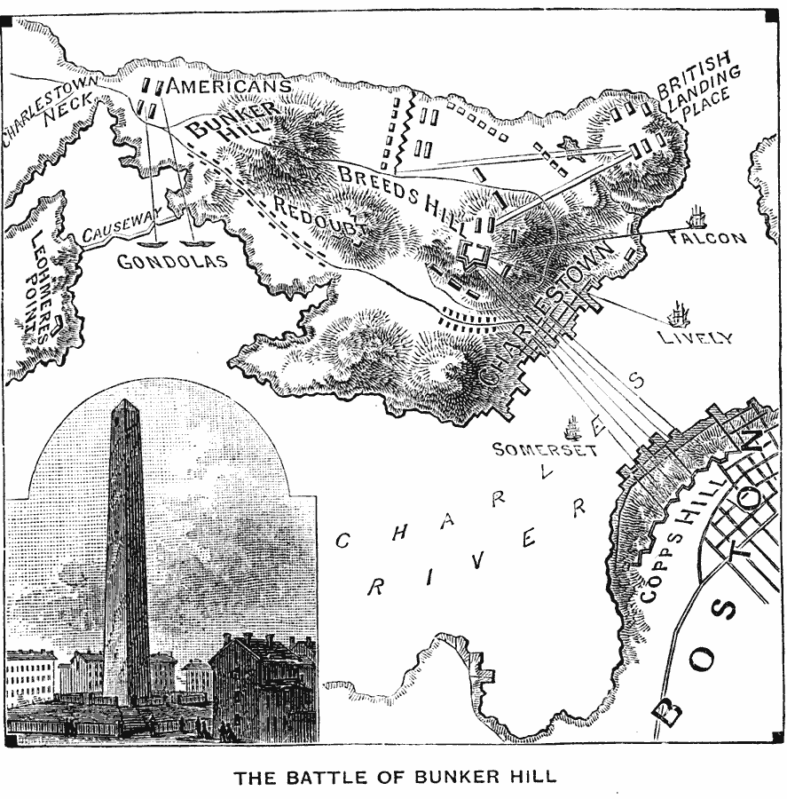
Description: A plan of the Battle of Bunker Hill (Breed's Hill) on the Charlestown peninsula in Boston Harbor (June 17, 1775), showing the American and British positions, the breastworks and redoubt built by the Americans, the artillery positions of the British on Copp's Hill, Morton's Hill, and naval positions of the British ship Falcon, Lively, and Somerset in the Charles River, and the gondolas near Charles Neck, with ranges given.
Place Names: Early America 1400-1800, Boston, �Breeds Hill, �Bunker Hill, �Charles River, �Charlestown, �Copps Hill, �New England, �Somerset, �American Revolutio
ISO Topic Categories: oceans,
location,
inlandWaters
Keywords: The Battle of Bunker Hill, historical, �local jurisdictions, �other military, �water route, �transportation, kAmericanRevolution, kBattle, local jurisdictions, water routes, other military,
historical event, oceans,
location,
inlandWaters, Unknown, June 17, 1775
Source: William Swinton, First Lessons in Our Countries History (New York, NY: American Book Company, 1894) 87
Map Credit: Courtesy the private collection of Roy Winkelman |
|