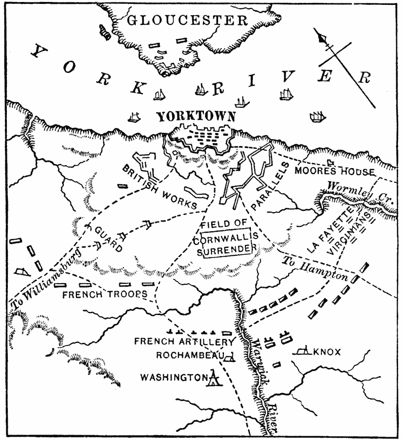
Description: A map of the Colonial Virginia area where the Siege of Yorktown took place in 1781. The map shows the British held city of Yorktown on the York River, the city of Gloucester, the British works, redoubts, and fortifications, roads to Hampton and Williamsburg, the American control of the York River by the fleet under the Comte de Grasse, the positions of the French troops, headquarters, and artillery under the Comte de Rochambeau, the positions and headquarters of the American troops under Washington and Knox, the position of the Virginians under La Fayette, the Moore's House where initial surrender negotiations took place, and the field of the surrender of Charles Cornwallis.
Place Names: Early America 1400-1800, Gloucester, �Warwick River, �Washington D.C., �Williamsburg, �York River, �American Revolution, �Colonial America, �French, �Englis
ISO Topic Categories: oceans,
location,
inlandWaters
Keywords: The Siege of Yorktown, historical, �other military, �water route, �transportation, �local jurisdictions, water routes, other military,
historical event, oceans,
location,
inlandWaters, Unknown, 1781
Source: William Swinton, First Lessons in Our Countries History (New York, NY: American Book Company, 1894) 104
Map Credit: Courtesy the private collection of Roy Winkelman |
|