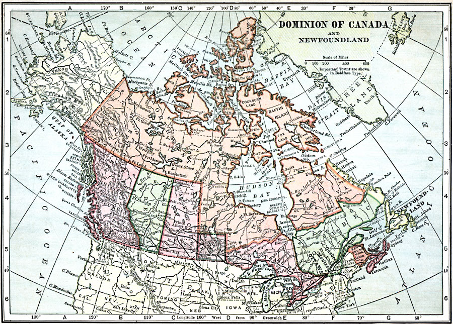
Description: A map from 1909 of the Dominion of Canada and Newfoundland showing the provinces at the time, provincial capitals, major cities, towns, and settlements, railways, mountain systems, lakes, rivers, coastal features, and islands of the region.
Place Names: Canada, Alaska, �British Columbia, �Calgary, �Churchill, �Edmonton, �Greenland, �Manitoba, �Montreal, �Ottawa, �Quebec, �Toronto, �Vancouver, �Victoria, �Winnipeg, �Yuko
ISO Topic Categories: oceans,
location,
inlandWaters
Keywords: The Dominion of Canada and Newfoundland, country borders, �political, � country borders, oceans,
location,
inlandWaters, Unknown, 1909
Source: C. S. Hammond, Hammond's Handy Atlas of the World (New York, NY: C. S. Hammond & Company, 1911) 9
Map Credit: Courtesy the private collection of Roy Winkelman |
|