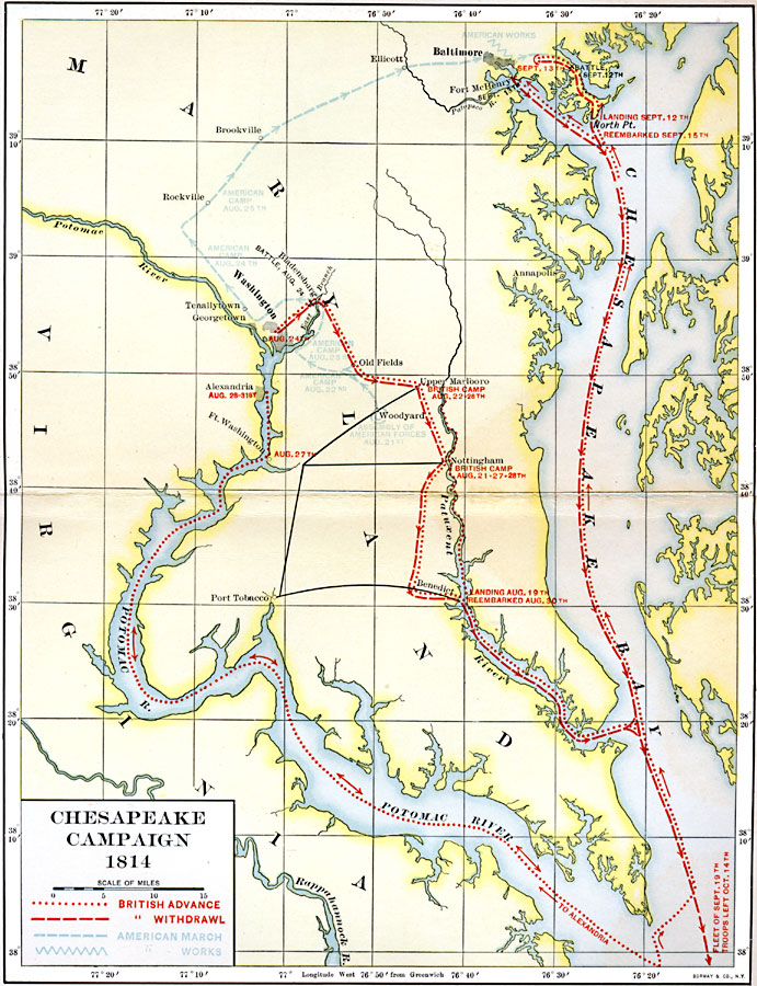
Description: A map of the Chesapeake Campaign (1814) of the War of 1812 showing the routes of British advance and retreat on the capture of the city of Washington and Battle of Baltimore, the routes of the American forces, American fortifications, and battle sites.
Place Names: Maryland,
ISO Topic Categories: boundaries,
environment,
intelligenceMilitary,
location,
inlandWaters,
transportation
Keywords: Chesapeake Campaign, political, �physical, physical features, boundaries,
environment,
intelligenceMilitary,
location,
inlandWaters,
transportation, 1814
Source: Albert Bushnell Hart, LL.D., The American Nation Vol. 13 (New York, NY: Harper and Brothers, 1906) 136
Map Credit: Courtesy the private collection of Roy Winkelman |
|