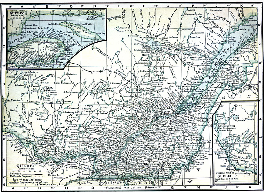
Description: A map from 1909 of the province of Quebec, showing the more populous region around the St. Lawrence River from Montreal to Quebec and north to the mouth of the river into the Gulf of St. Lawrence. The map shows major cities and towns, existing and proposed railways, lakes and rivers. Two inset maps detail the Gulf of St. Lawrence with Gaspé Peninsula and Anticosti Island, and the western part of Quebec along the Ottawa River near Lake Temiskaming.
Place Names: Canada, Montreal, �Ottawa, �Quebe
ISO Topic Categories: oceans,
location,
inlandWaters
Keywords: Province of Quebec, borders, �political, �railroad, �transportation, county borders, railroads, oceans,
location,
inlandWaters, Unknown, 1909
Source: C. S. Hammond, Hammond's Handy Atlas of the World (New York, NY: C. S. Hammond & Company, 1911) 11
Map Credit: Courtesy the private collection of Roy Winkelman |
|