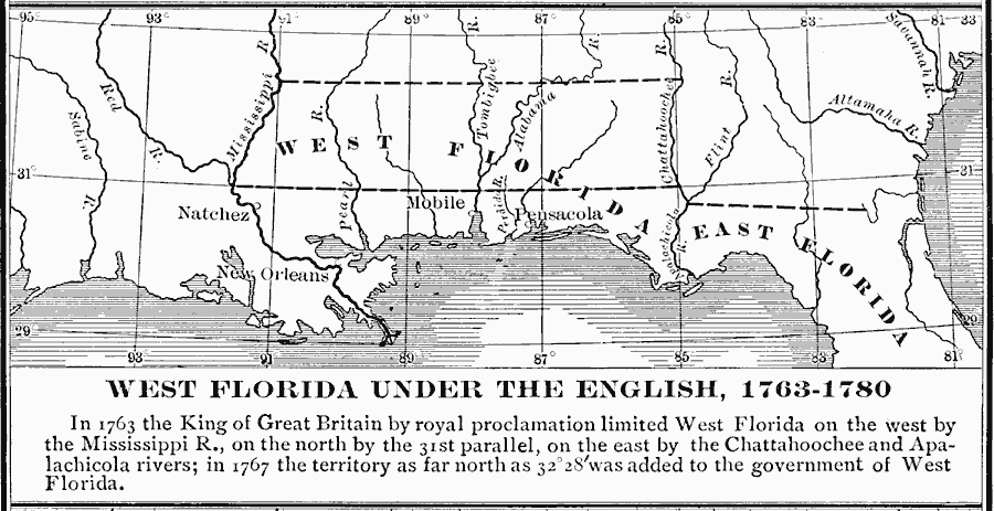
Description: A map of West Florida as a British possession between 1763 and 1780. In 1763, the King of Great Britain by royal proclamation limited West Florida on the west by the Mississippi River, on the north by the 31st parallel, on the east by the Chattahoochee and Apalachicola rivers.
Place Names: Early America 1400-1800, New Orleans, �Mobile, �Pensacola, �Englis
ISO Topic Categories: inlandWaters,
location,
oceans,
boundaries
Keywords: West Florida Under the English, physical, �political, physical features, country borders, inlandWaters,
location,
oceans,
boundaries, Unknown, 1763–1780
Source: Albert Bushnell Hart, LL.D., The American Nation Vol 12 (New York, NY: Harper and Brothers, 1906) 142
Map Credit: Courtesy the private collection of Roy Winkelman |
|
