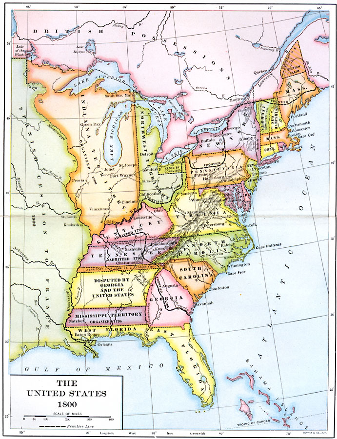
Description: A map of the United States in 1800 showing the territorial claims of the states at the time, the British and French possessions, and territory disputes. The map shows the frontier lines or extent of settlement from the coast of Maine to Savannah, including the area along the St. Lawrence and lands south of the Ohio River. The map shows the Indiana Territory organized in 1800, the Northwest Territory, Western Reserve ceded by Connecticut in 1800, Vermont admitted into the Union in 1791, the northern territory of Massachusetts that eventually became Maine and the disputed territory with Britain, Kentucky admitted in 1792, Tennessee admitted in 1796 including the territory claimed by South Carolina until 1787, the western territory disputed by Georgia and the United States, the Mississippi Territory between the Mississippi River and Chattahoochee River organized in 1798. The map also shows the Spanish possessions of West and East Florida, the French possession of the territory west of the Mississippi, and the British territory of Canada.
Place Names: Early America 1400-1800, Boston, �New York, �Philadelphia, �Detroit, �New Orlean
ISO Topic Categories: boundaries,
inlandWaters,
location,
oceans
Keywords: The United States, physical, �political, physical features, major political subdivisions, boundaries,
inlandWaters,
location,
oceans, Unknown, 1800
Source: Albert Bushnell Hart, LL.D., The American Nation Vol 11 (New York, NY: Harper and Brothers, 1906) 176
Map Credit: Courtesy the private collection of Roy Winkelman |
|
