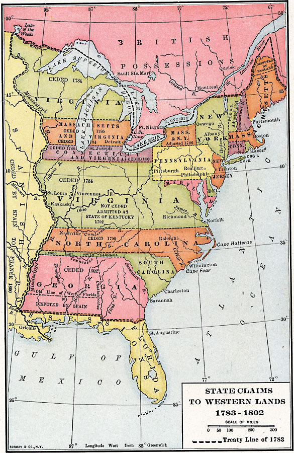
Description: A map of the United States east of the Mississippi River showing the State claims between 1783–1802. The map shows the western territorial boundary established by the Treaty of 1783 between Britain and the United States, the State claims to the western lands with the dates of claims ceded by the States, the disputed territory of West Florida between Spain and Georgia, the disputed territory in northern Massachusetts (Maine), and notes the Kentucky Territory south of the Ohio River not ceded but admitted as the State of Kentucky in 1792.
Place Names: Early America 1400-1800, Boston, �New Orleans, �New York, �Richmond, �Detroi
ISO Topic Categories: boundaries,
inlandWaters,
location,
oceans
Keywords: State Claims to Western Lands, physical, �political, physical features, country borders,
major political subdivisions, boundaries,
inlandWaters,
location,
oceans, Unknown, 1783–1802
Source: Albert Bushnell Hart, LL.D., The American Nation Vol 10 (New York, NY: Harper and Brothers, 1906) 108
Map Credit: Courtesy the private collection of Roy Winkelman |
|