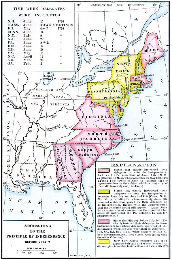
Description: A map of the Thirteen Colonies color–coded to show the accessions to the principal of Independence before July 2, 1776. The map shows when the colonial delegates to the Continental Congress were instructed to vote on the Declaration of Independence.
Place Names: Early America 1400-1800, Boston, �New York, �New Orleans, �Philadelphia, �Pittsburg, �American Revolutio
ISO Topic Categories: boundaries,
location,
oceans,
inlandWaters
Keywords: Accessions to the Principal of Independence, physical, �political, physical features, major political subdivisions,
country borders, boundaries,
location,
oceans,
inlandWaters, Unknown, 1776
Source: Albert Bushnell Hart, LL.D., The American Nation Vol 9 (New York, NY: Harper and Brothers, 1906) 68
Map Credit: Courtesy the private collection of Roy Winkelman |
|
