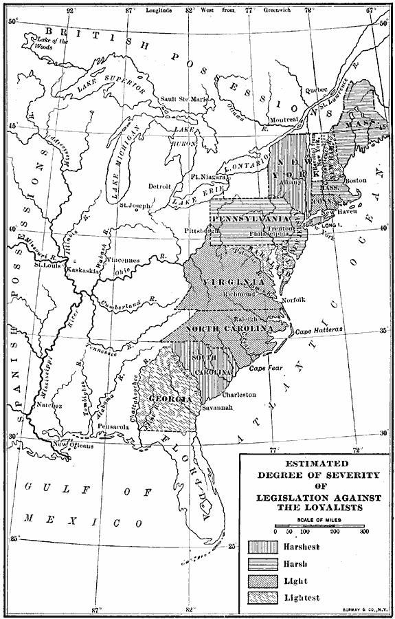
Description: A map of the American colonies during the civil war between the Whigs and Tories (Loyalists) at the time of the American Revolutionary War. The map shows the estimated degree of severity of legislation against the Loyalists, ranging from harsh in the northern colonies to light in the southern colonies.
Place Names: Early America 1400-1800, Boston, �New York, �New Orleans, �American Revolutio
ISO Topic Categories: boundaries,
inlandWaters,
location,
oceans
Keywords: Estimated Degree of Severity of Legislation Against the Loyalists, physical, �political, kAmericanRevolution, physical features, country borders,
major political subdivisions, boundaries,
inlandWaters,
location,
oceans, Unknown, 1777–1780
Source: Albert Bushnell Hart, LL.D., The American Nation Vol 9 (New York, NY: Harper and Brothers, 1906) 250
Map Credit: Courtesy the private collection of Roy Winkelman |
|