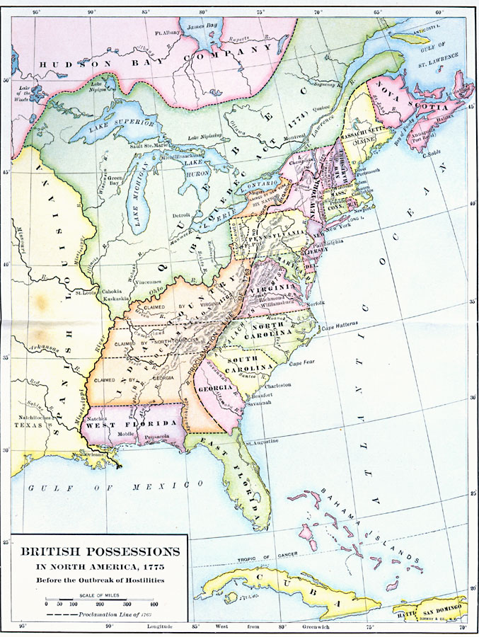
Description: A map showing the British possessions in North America in 1775, before the outbreak of hostilities during the American Revolutionary War. The map shows the boundaries of the British Colonies along the Atlantic, the Proclamation Line of 1763 after the French and Indian Wars, the extent of Quebec to the Ohio River, the territories reserved for the Indians west of the Allegheny Mountains and east of the Mississippi River, the territory claimed by the Six Nations (Iroquois), Spanish Louisiana, East and West Florida, and the territory claimed by the Hudson Bay Company.
Place Names: Early America 1400-1800, Boston, �New York, �New Orleans, �Colonial Americ
ISO Topic Categories: boundaries,
location,
oceans,
inlandWaters
Keywords: British Possessions in North America, physical, �political, physical features, major political subdivisions,
country borders, boundaries,
location,
oceans,
inlandWaters, Unknown, 1775
Source: Albert Bushnell Hart, LL.D., The American Nation Vol 8 (New York, NY: Harper and Brothers, 1906) 298
Map Credit: Courtesy the private collection of Roy Winkelman |
|