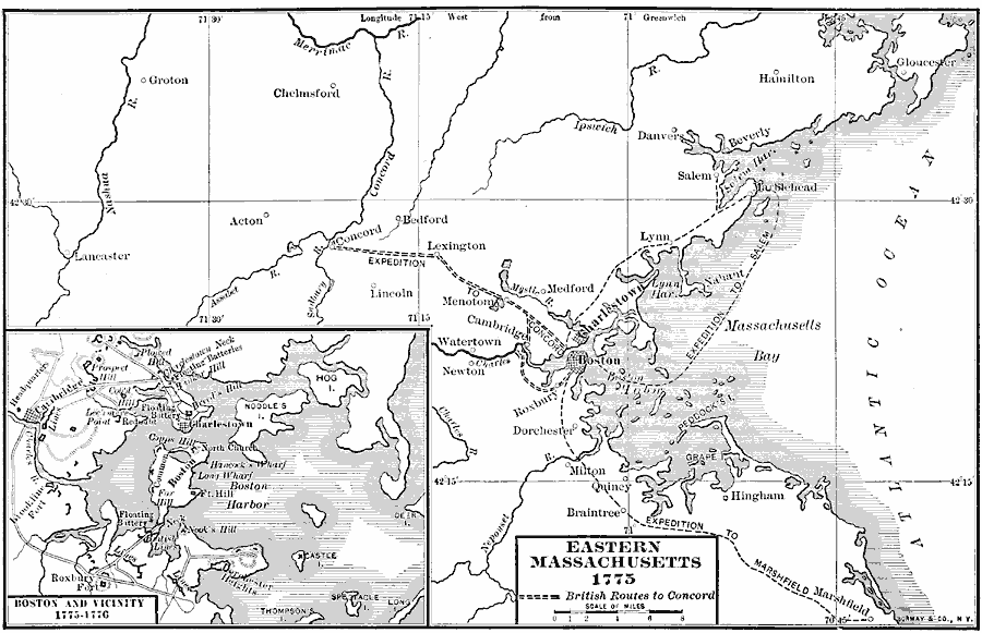
Description: A map of eastern Massachusetts in 1775, showing the coastline of Massachusetts Bay, Boston, Charleston, Concord, Marshfield and other settlements, and the routes of the British expeditions to Salem, Concord, and Marshfield. An inset map details the vicinity of Boston in 1775–1776, showing several significant sites at the outbreak of the American Revolutionary War.
Place Names: Early America 1400-1800, Boston, �Colonial Americ
ISO Topic Categories: boundaries,
location,
oceans,
inlandWaters
Keywords: Eastern Massachusetts, physical, �political, kAmericanRevolution, physical features, major political subdivisions,
county borders, boundaries,
location,
oceans,
inlandWaters, Unknown, 1775–1776
Source: Albert Bushnell Hart, LL.D., The American Nation Vol 8 (New York, NY: Harper and Brothers, 1906) 310
Map Credit: Courtesy the private collection of Roy Winkelman |
|