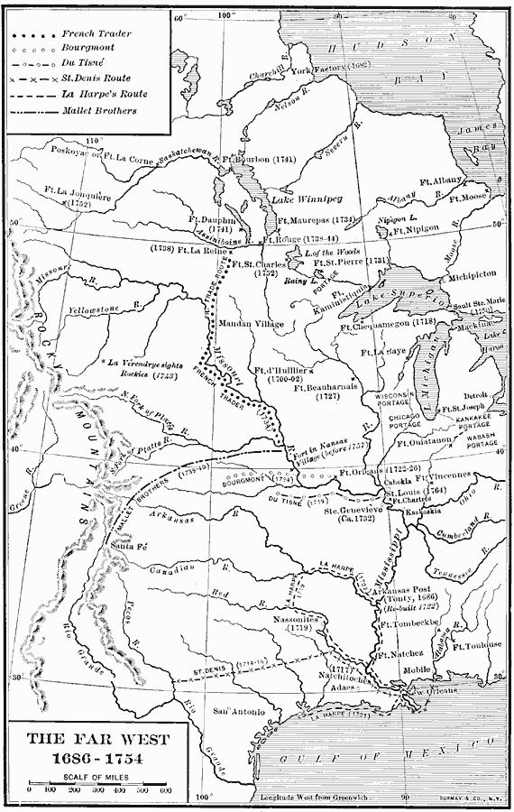
Description: A map of the region from the Great Lakes to the Gulf of Mexico and from the Rockies to east of the Mississippi River in 1686–1754, showing the French exploration and trade routes in the area at the time. The map shows forts, rivers, European and Native American settlements, the French trade route between Fort La Reine on the Assiniboine River to the confluence of the Missouri and Platte rivers, and the routes of Bourgmont, Du Tisné, St. Denis, La Harpe, and the Mallet brothers. The dates of exploration and establishment of forts and settlements is given in parentheses.
Place Names: Early America 1400-1800, Chicago, �New Orleans, �Detroit, �Colonial America, �Discover
ISO Topic Categories: boundaries,
location,
oceans,
inlandWaters
Keywords: The Far West, physical, �political, physical features, local jurisdictions, boundaries,
location,
oceans,
inlandWaters, Unknown, 1686–1754
Source: Albert Bushnell Hart, LL.D., The American Nation Vol 7 (New York, NY: Harper and Brothers, 1906) 74
Map Credit: Courtesy the private collection of Roy Winkelman |
|