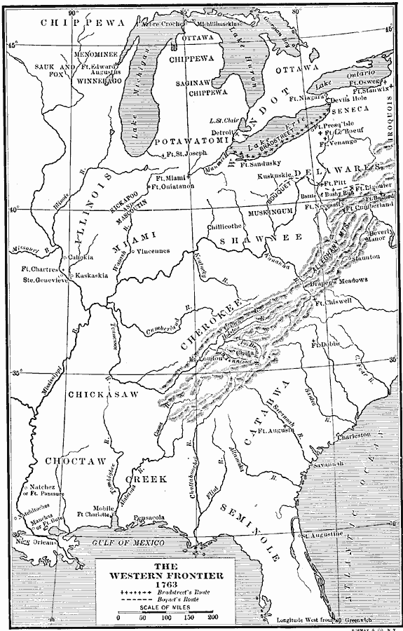
Description: A map of eastern North America and the Northwest Territory in 1763 during Pontiac's Rebellion at the end of the French and Indian Wars. The map shows the general tribal lands east of the Mississippi River of the Ottawa, Potawatomi, Wandot, Seneca, Iroquois, Delaware, Muskingum, Shawnee, Chippewa, Saginaw, Menominee, Sauk and Fox, Winnebago, Kickapoo and Mascoutin, Miami, Cherokee, Chickasaw, Catabwa, Choctaw, Creek, and Seminole, the French and British forts and settlements, the battle sites of Bushy Run and Devil's Hole, and the routes of the British campaigns under John Bradstreet and Henry Bouquet.
Place Names: Early America 1400-1800, New Orlean
ISO Topic Categories: transportation,
location,
oceans,
planningCadastre,
boundaries
Keywords: The Western Frontier and Pontiac's Rebellion, physical, �political, �transportation, �frontier, kNativeAmerican, physical features, local jurisdictions, roads,
water routes, transportation,
location,
oceans,
planningCadastre,
boundaries, Unknown, 1763
Source: Albert Bushnell Hart, LL.D., The American Nation Vol 7 (New York, NY: Harper and Brothers, 1906) 256
Map Credit: Courtesy the private collection of Roy Winkelman |
|
