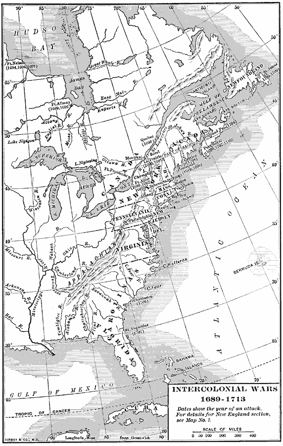
Description: A map of eastern colonial North America showing the struggle for supremacy between England, France, and Spain in the region, from the King William's War (1689–1692) to Queen Anne's War (1702–1713), a period also known as the Intercolonial Wars or French and Indian Wars (not to be confused with the French and Indian War of 1754–1763). This map shows the settlements and outposts attacked with the dates of attack given in parentheses. The principal areas of conflict were the English Hudson Bay Company claims in the north, the fishing grounds of Newfoundland and Nova Scotia, the frontier lands in Acadia, St. Lawrence, Maine, and Hudson River Valley, and in the south, the Carolinas and Spanish Florida.
Place Names: Early America 1400-1800, Boston, �New York, �Colonial Americ
ISO Topic Categories: boundaries,
inlandWaters,
oceans,
location,
intelligenceMilitary
Keywords: Intercolonial Wars, physical, �political, �historical, physical features, major political subdivisions, other military, boundaries,
inlandWaters,
oceans,
location,
intelligenceMilitary, Unknown, 1689–1713
Source: Albert Bushnell Hart, LL.D., The American Nation Vol 6 (New York, NY: Harper and Brothers, 1906) 122
Map Credit: Courtesy the private collection of Roy Winkelman |
|