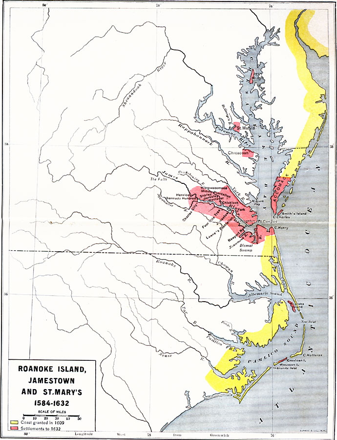
Description: A map of the Chesapeake Bay and Pamlico Sound area showing the initial Virginia Colony established by Sir Walter Raleigh and Queen Elizabeth I in 1584 through the European settlements established by 1634, including Roanoke Island, Jamestown (1607), and St. Mary's, Maryland (1632). The map is color–coded to show the coastal areas granted in 1609, and the areas settled by 1632.
Place Names: Early America 1400-1800, Roanoke, �St. Mary's, �Jamestown, �Colonial Americ
ISO Topic Categories: boundaries,
location,
oceans,
inlandWaters
Keywords: Roanoke Island, Jamestown, and St. Mary's, physical, �political, physical features, local jurisdictions, boundaries,
location,
oceans,
inlandWaters, Unknown, 1584–1632
Source: Albert Bushnell Hart, LL.D., The American Nation Vol 4 (New York, NY: Harper and Brothers, 1906) 34
Map Credit: Courtesy the private collection of Roy Winkelman |
|