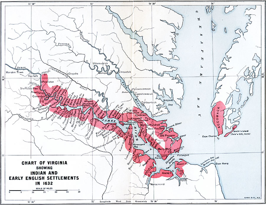
Description: A map of the lower James River, Chesapeake Bay, and Accomack County, showing the early English settlements in the Virginia Colony in 1632. The map is keyed to show the extent of English settlement at the time, and shows the Native American settlements with triangle symbols, English settlements with circles.
Place Names: Early America 1400-1800, Colonial Americ
ISO Topic Categories: inlandWaters,
location,
oceans
Keywords: Chart of Early Virginia, physical, �political, kNativeAmerican, physical features, local jurisdictions, inlandWaters,
location,
oceans, Unknown, 1632
Source: Albert Bushnell Hart, LL.D., The American Nation Vol 4 (New York, NY: Harper and Brothers, 1906) 76
Map Credit: Courtesy the private collection of Roy Winkelman |
|