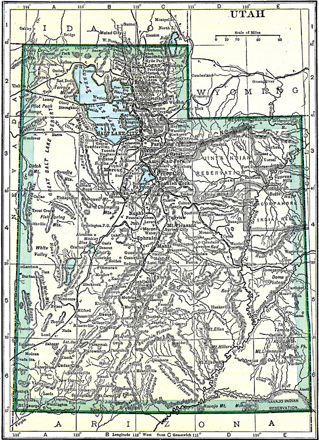
Description: A map from 1919 of Utah showing the capital at Salt Lake City, principal cities and towns, Indian reservations, railroads, mountains, lakes, rivers, and the Great Salt Lake Desert region to the west of Salt Lake.
Place Names: Utah, Ogden, �Salt Lake City, �Provo, �Brigham, �Corinne, �Eureka, �Parowan, �St. Georg
ISO Topic Categories: boundaries,
inlandWaters,
location,
transportation
Keywords: Utah, physical, �political, �transportation, kNativeAmerican, physical features, major political subdivisions, railroads, boundaries,
inlandWaters,
location,
transportation, Unknown, 1919
Source: Charles Morris, Winston's Cumulative Encyclopedia Vol 10 (Philadelphia, PA: The John C. Winston Company, 1919) tab 9
Map Credit: Courtesy the private collection of Roy Winkelman |
|