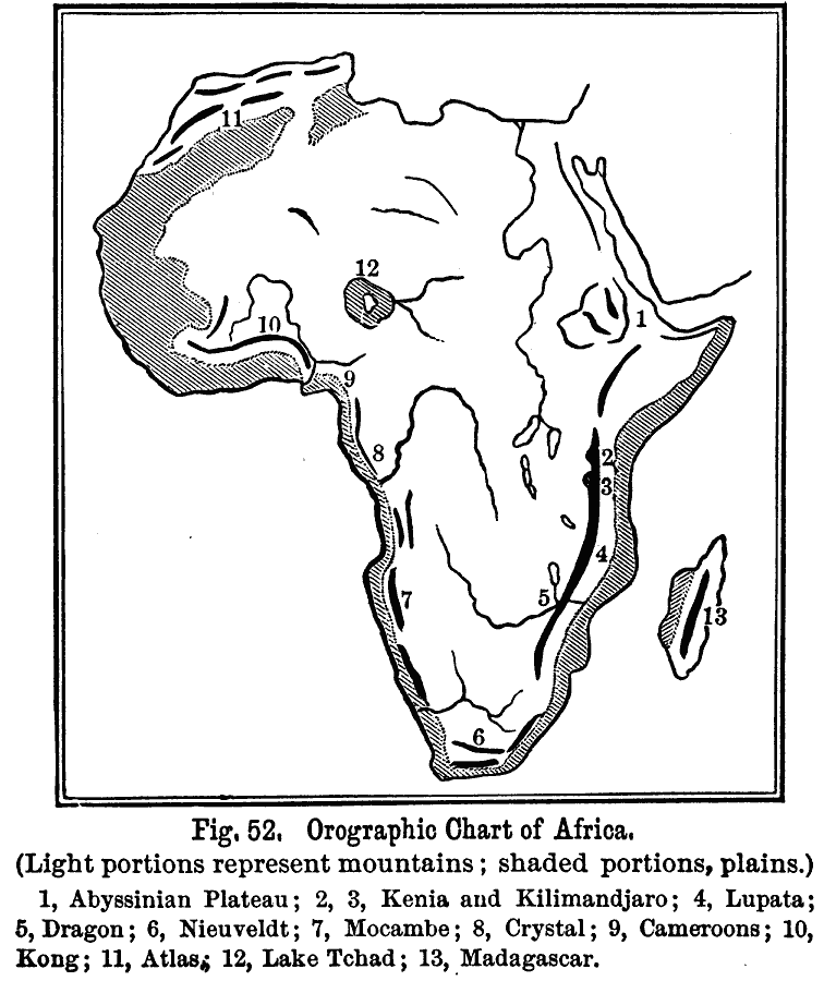
Description: An outline map showing the various mountain features and plains on the African continent. The map has reference numbers to the prominent features, and includes the inland drainage basin of Lake Tchad.
Place Names: A Complete Map of Africa, Algeria, �Congo, �Egypt, �Ethiopia, �Lybia, �Madagascar, �Nigeria, �Somalia, �South Africa, �Sudan, Abyssinian Plateau, Mt. Kenya, Mt. Kilimanjaro, Lupata Range, Dragon Range, Nieuveldt, Mocambe Range, Crystal, Cameroons, Kong Range, Atlas Mountains, Lake Tchad
ISO Topic Categories: oceans,
location,
inlandWaters
Keywords: Orographic Chart of Africa, land, �mountains, �water, �physical, kRelief, physical features,
topographical, oceans,
location,
inlandWaters, Unknown, 1891
Source: Edwin J. Houston, A. M. , The Elements of Physical Geography (Philadelphia, PA: Eldredge & Brother, 1891) 52
Map Credit: Courtesy the private collection of Roy Winkelman |
|