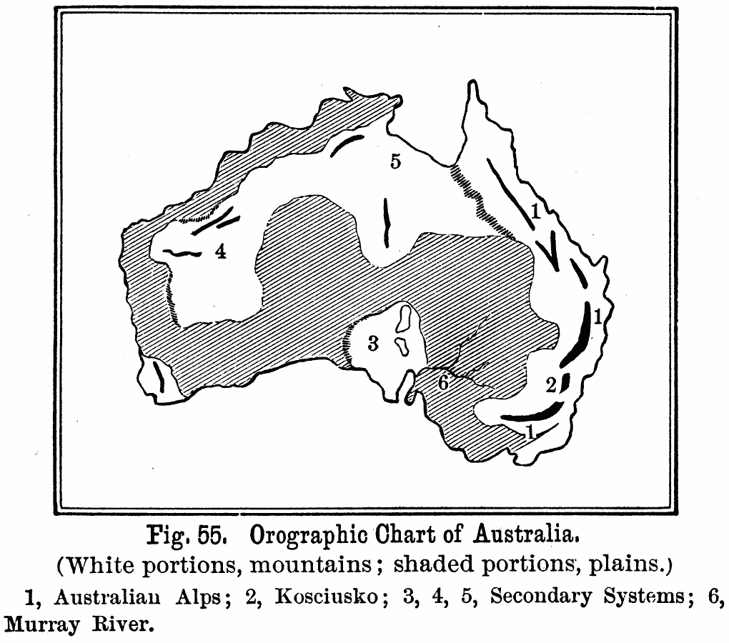
Description: A black and white map showing the various orographic systems in Australia, including the prominent mountain systems and plains. This map shows (1) the Australian Alps, or the Great Dividing Range, (2) Mount Kosciusko (Kosciuszko) in the Blue Mountains, and secondary mountain systems in (3) South Australia, (4) Western Australia, (5) Northern Territory, and (6) the Murray River system in southern Australia.
Place Names: A Complete Map of Australia, Alice Springs, �Brisbane, �Cairns, �Canberra, �Darwin, �Mackay, �Melbourne, �Newcastle, �Sydney, �Townsvill
ISO Topic Categories: oceans,
location,
inlandWaters
Keywords: Orographic Chart of Australia, land, �mountains, �water, �physical, kOrographic, physical features,
topographical, oceans,
location,
inlandWaters, Unknown, 1891
Source: Edwin J. Houston, A. M. , The Elements of Physical Geography (Philadelphia, PA: Eldredge & Brother, 1891) 54
Map Credit: Courtesy the private collection of Roy Winkelman |
|