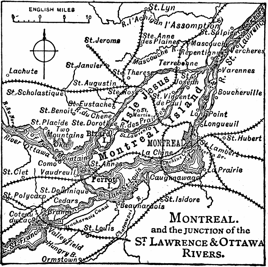
Description: A map from 1919 of Montreal at the confluence of the Ottawa and St. Lawrence Rivers and vicinity, showing the city, railroads, the Island of Montreal, Isle of Jesus, Perrot Island, Rivière des Prairies, Lake St. Francis and Lake St. Louis, and the neighboring cities and towns of Longueil, Varennes, St. Hubert, La Prairie, St. John's, La Chine, Caughnawaga, Ormstown, and St. Anne.
Place Names: Canada, Montrea
ISO Topic Categories: inlandWaters,
location,
transportation
Keywords: Montreal and Vicinity, physical, �transportation, physical features, railroads, inlandWaters,
location,
transportation, Unknown, 1919
Source: Charles Morris, Winston's Cumulative Encyclopedia Vol 7 (Philadelphia, PA: The John C. Winston Company, 1919) tab 2
Map Credit: Courtesy the private collection of Roy Winkelman |
|