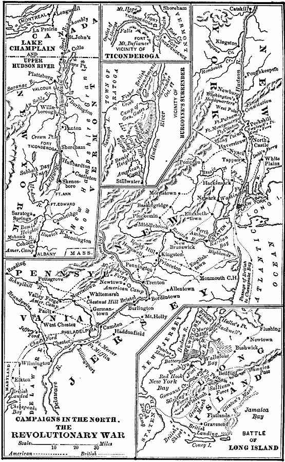
Description: A series of maps showing the northern campaigns of the American Revolutionary War, including the Hudson Valley and Saratoga campaign, a detail of Ticonderoga, the vicinity of Burgoyne's surrender, the Battle of Long Island, and an over–view map covering the area from Catskill on the Hudson to Elkton in Maryland.
Place Names: Early America 1400-1800, Massachusetts, �New Jersey, �New York, �Pennsylvania, �Philadelphia, �Vermont, �American Revolutio
ISO Topic Categories: oceans,
location,
inlandWaters
Keywords: Campaigns in the North — The Revolutionary War, American Revolution, �battles, �colonies, �historical, kAmericanRevolution, American Revolution, oceans,
location,
inlandWaters, Unknown, 1775–1783
Source: A. S. Barnes, A Brief History of the United States (New York, NY: American Book Company, 1885)
Map Credit: Courtesy the private collection of Roy Winkelman |
|