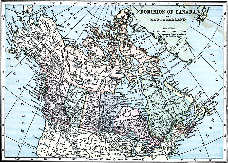
Description: A map from 1919 of the Dominion of Canada and Newfoundland (Newfoundland and Labrador were not part of the Canadian Confederation until 1949), showing the provinces at the time, provincial capitals, major cities, towns, and settlements, railways, mountain systems, lakes, rivers, coastal features, and islands of the region.
Place Names: Canada, Ottawa, �Winnipeg, �Victoria, �Vancouver, �Calgary, �Edmonton, �Montreal, �Quebec, �Toront
ISO Topic Categories: boundaries,
transportation,
inlandWaters,
location,
oceans
Keywords: The Dominion of Canada, physical, �political, �transportation, physical features, country borders,
major political subdivisions, railroads, boundaries,
transportation,
inlandWaters,
location,
oceans, Unknown, 1919
Source: Charles Morris, Winston's Cumulative Encyclopedia Vol 2 (Philadelphia, PA: The John C. Winston Company, 1919) tab 7
Map Credit: Courtesy the private collection of Roy Winkelman |
|