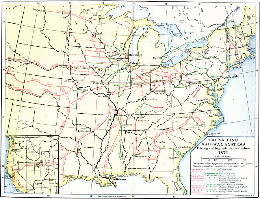
Description: A map showing the trunk line railway systems in the United States in 1875, disregarding minor branches, with the parent companies given. The map is color–coded and keyed to show the lines controlled by parent companies in 1865 in green, and lines acquired or constructed between 1865 and 1875 in red.
Place Names: Transportation, New York, �Boston, �Chicago, �Washington D.C., �New Orleans, �Houston, �railroad
ISO Topic Categories: transportation,
inlandWaters,
location,
oceans,
boundaries
Keywords: Trunk Line Railway Systems, physical, �political, �transportation, kTransportation, physical features, country borders,
major political subdivisions, railroads, transportation,
inlandWaters,
location,
oceans,
boundaries, Unknown, 1865–1875
Source: Albert Bushnell Hart, LL.D., The American Nation Vol. 22 (New York, NY: Harper and Brothers, 1907) 225
Map Credit: Courtesy the private collection of Roy Winkelman |
|