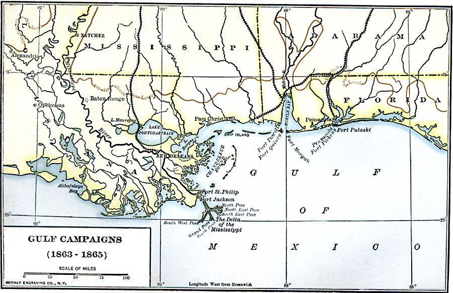
Description: A map of the Gulf Coast from the Mississippi Delta to Pensacola showing the area of the Gulf Campaigns during the Civil War, from 1863 to 1865. The map shows rivers, coastal features, the 100 foot elevation contour, railroads, forts, and the cities of New Orleans, Baton Rouge, Natchez, Pass Christian, and Pensacola.
Place Names: Civil War, New Orleans, �Pensacol
ISO Topic Categories: boundaries,
inlandWaters,
location,
oceans,
intelligenceMilitary,
transportation
Keywords: Gulf Campaigns of the Civil War, physical, �political, �transportation, physical features, country borders,
major political subdivisions, railroads, boundaries,
inlandWaters,
location,
oceans,
intelligenceMilitary,
transportation, Unknown, 1863–1865
Source: Albert Bushnell Hart, LL.D., The American Nation Vol. 21 (New York, NY: Harper and Brothers, 1907) 168
Map Credit: Courtesy the private collection of Roy Winkelman |
|