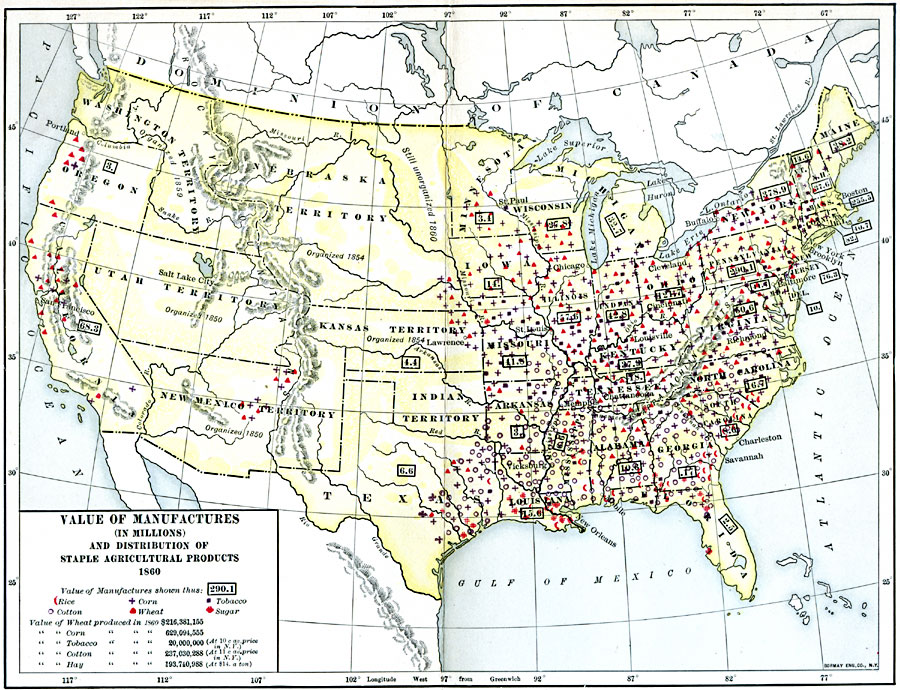
Description: A map of the United States showing the value of manufactures (in millions) and distribution of staple agricultural products in 1860. The map illustrates the disparity between the manufacturing–based economy in the northern region and slave–dependent agricultural economy of the southern region just prior to the outbreak of the Civil War. The map is keyed to show areas of agricultural production for rice, corn, tobacco, wheat, sugar, and the principal economic crop of cotton. The map gives the annual value for production of wheat, corn, tobacco, cotton, and hay in 1860.
Place Names: Industry, Boston, �Chicago, �New Orleans, �New York, �Washington D.C., �manufacturin
ISO Topic Categories: boundaries,
inlandWaters,
location,
oceans,
transportation,
society
Keywords: Value of Manufactures, physical, �political, �statistical, kAgriculture, physical features, country borders,
major political subdivisions, industry,
agriculture, boundaries,
inlandWaters,
location,
oceans,
transportation,
society, Unknown, 1860
Source: Albert Bushnell Hart, LL.D., The American Nation Vol. 19 (New York, NY: Harper and Brothers, 1907) 8
Map Credit: Courtesy the private collection of Roy Winkelman |
|