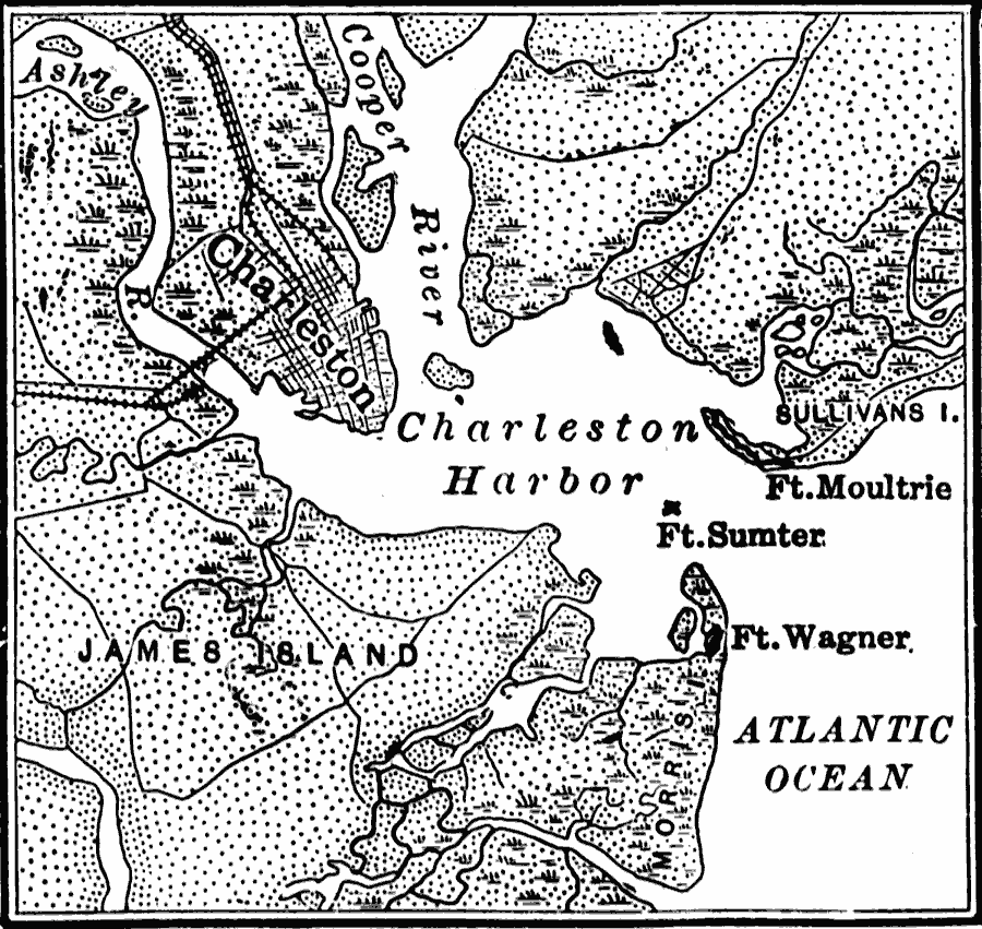
Description: A map of the Charleston Harbor, South Carolina, site of the Battle of Fort Sumter (April 12–13, 1861) at the outbreak of the American Civil War. The map shows the city of Charleston and railroads, the Union held Fort Sumter at the mouth of the Charleston Harbor, Confederate held Fort Moultrie on Sullivan's Island on the northern approach to the harbor, and Confederate held Fort Wagner on Morris Island on the southern approach to the harbor.
Place Names: Civil War, Charleston, �Fort Multrie, �Fort Sumter, �Fort Wagner, �James Island, �South Carolina,
ISO Topic Categories: oceans,
location,
inlandWaters,
boundaries
Keywords: Charleston Harbor, borders, �historical, �physical, �physical features, historical event, oceans,
location,
inlandWaters,
boundaries, Unknown, 1861
Source: S.E. Forman, Advanced American History (New York, NY: The Century Company, 1919) 431
Map Credit: Courtesy the private collection of Roy Winkelman |
|