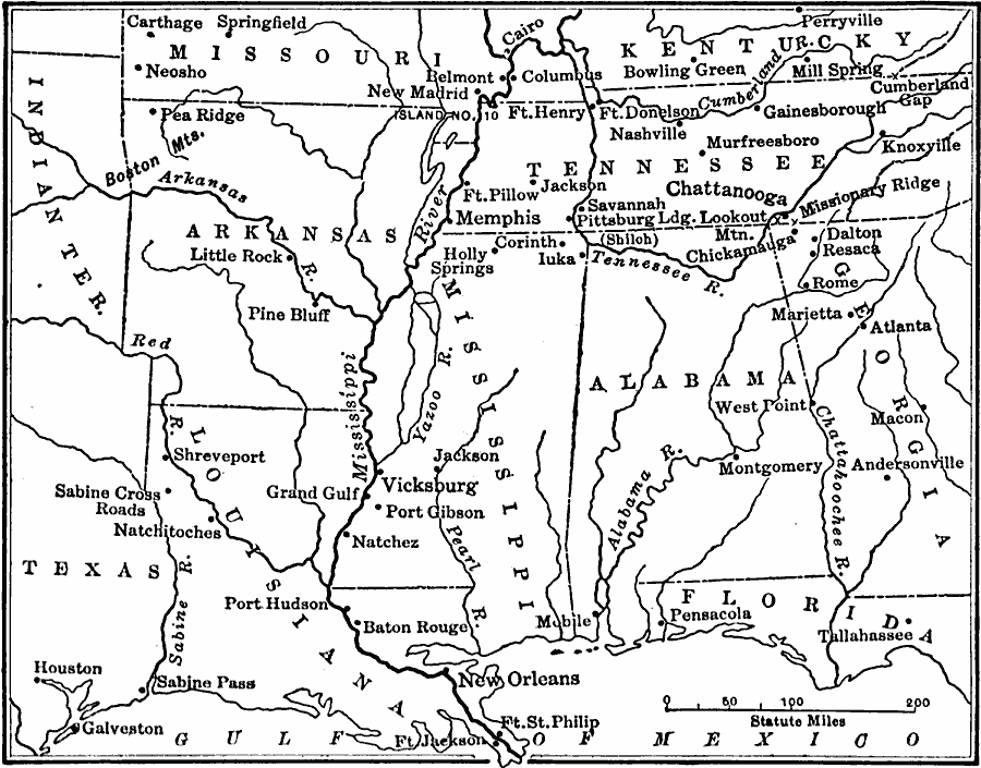
Description: A map of the western seat of war during the American Civil War, showing cities, forts, rivers, and significant battle sites.
Place Names: Civil War, Alabama, �Arkansas, �Florida, �Georgia, �Indian territory, �Kentucky, �Louisiana, �Mississippi River, �Missouri, �Tennessee, �Texas, �United State
ISO Topic Categories: oceans,
location,
inlandWaters,
boundaries
Keywords: The War in the West, borders, �historical, �land, �war, �physical features, historical event, oceans,
location,
inlandWaters,
boundaries, Unknown, 1861–1865
Source: S.E. Forman, Advanced American History (New York, NY: The Century Company, 1919) 446
Map Credit: Courtesy the private collection of Roy Winkelman |
|