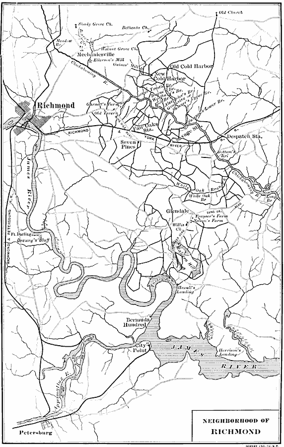
Description: A map of the area to the east of Richmond, Virginia, during the American Civil War (1861–1865). The map shows the railroads leading to the city, the James River and Chickahominy River, main roads in the area, and several major battle sites, including Mechanicsville, Gaines Mill, Cold Harbor, Fair Oaks, Seven Pines, White Oak Swamp, Malvern Hill, Harrison's Landing, and Petersburg.
Place Names: Civil War, Richmond, �Virginia
ISO Topic Categories: location,
inlandWaters,
transportation
Keywords: Neighborhood of Richmond, physical, �political, �transportation, physical features, local jurisdictions, roads,
railroads, location,
inlandWaters,
transportation, Unknown, 1861–1865
Source: Albert Bushnell Hart, LL.D., The American Nation Vol. 20 (New York, NY: Harper and Brothers, 1907) 130
Map Credit: Courtesy the private collection of Roy Winkelman |
|