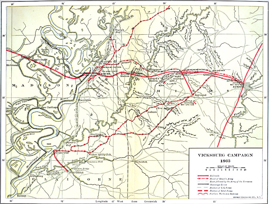
Description: A map detailing the Vicksburg Campaign (1863) of the American Civil War. The map shows cities and towns, roads and strategic railroads, terrain features and tributaries of the Mississippi River, and is keyed to show the march of Grant's Army, the route followed by the Army of the Tennessee, levees along the Mississippi, position of U.S. forces, position of Rebel forces, and Confederate works and defenses.
Place Names: Civil War, Vicksburg, �Jackso
ISO Topic Categories: intelligenceMilitary,
inlandWaters,
location,
transportation
Keywords: Vicksburg Campaign, political, �physical, �transportation, �historical, physical features, local jurisdictions, railroads,
roads, Civil War, intelligenceMilitary,
inlandWaters,
location,
transportation, Unknown, 1863
Source: Albert Bushnell Hart, LL.D., The American Nation Vol. 20 (New York, NY: Harper and Brothers, 1907) 271
Map Credit: Courtesy the private collection of Roy Winkelman |
|