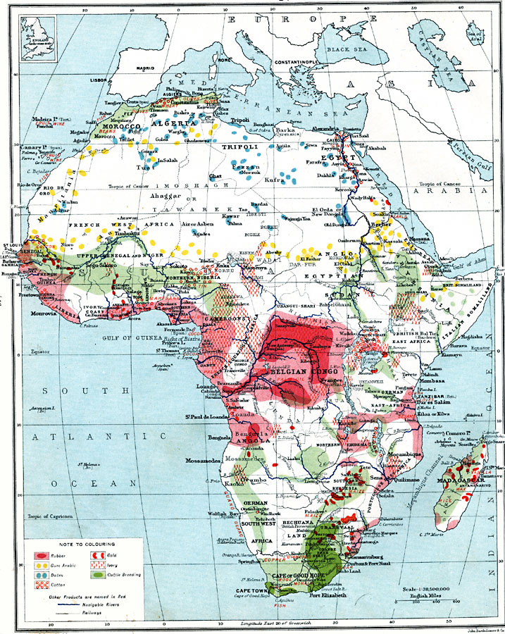
Description: A map from 1915 of Africa and Madagascar showing the principal economic products of the area. The map is keyed to show areas of production for rubber, gum arabic, dates, cotton, gold, ivory, and cattle breeding. Other products are named in red. The map shows principal cities, trading centers, ports, railroads, navigable rivers, and caravan routes. An outline map of England at the same map scale is given to show relative area size.
Place Names: A Complete Map of Africa, Algeria, �Congo, �Egypt, �Lybia, �Madagascar, �Nigeria, �Somalia, �South Africa, �Suda
ISO Topic Categories: inlandWaters,
oceans,
location,
boundaries,
transportation,
farming,
economy
Keywords: Economic Map of Africa, physical, �political, �borders, �boundaries, �statistical, �agriculture, �industry, �economic, �transportation, �routes, �railroads, physical features, country borders, industry,
economic,
agriculture, water routes,
railroads, inlandWaters,
oceans,
location,
boundaries,
transportation,
farming,
economy, Unknown, 1915
Source: J.G. Bartholomew, A School Economic Atlas (London, England: Oxford University Press, 1915) 38
Map Credit: Courtesy the private collection of Roy Winkelman |
|