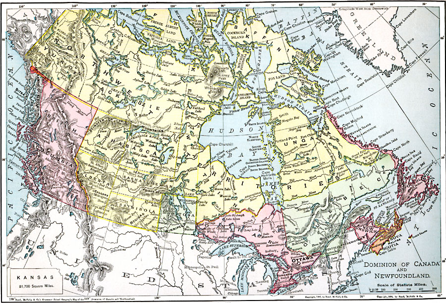
Description: A map from 1901 of the Dominion of Canada and Newfoundland (Newfoundland and Labrador did not become a province of Canada until 1949). The map shows the province boundaries at the time, including Athabasca, Assiniboia, Keewatin, Ungava, Franklin, Mackenzie, and the boundaries before their territorial expansion of Manitoba (1912) and Saskatchewan (1905). The map shows major cities and towns, terrain and coastal features, rivers, and lakes of the region. An outline map of Kansas is included to show comparative area size.
Place Names: Canada, Calgary, �Churchill, �Edmonton, �Montreal, �New Brunswick, �Newfoundland, �Ottawa, �Quebec, �Toronto, �Vancouver, �Victoria, �Winnipe
ISO Topic Categories: oceans,
location,
inlandWaters
Keywords: The Dominion of Canada and Newfoundland, borders, �physical, kComparativeArea, country borders, oceans,
location,
inlandWaters, Unknown, 1901
Source: James A. Bowen, Grammar School Geography (Chicago, IL: Rand, McNally & Company, 1901) 141
Map Credit: Courtesy the private collection of Roy Winkelman |
|