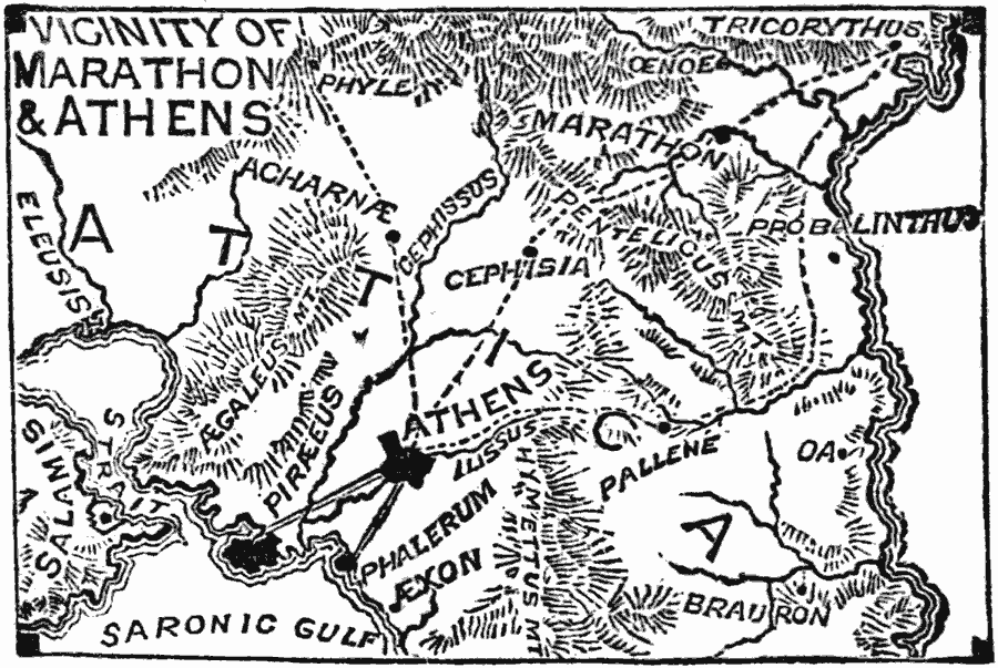
Description: A map of Athens and Marathon in Attica, Greece, at the time of the Persian Invasion under Darius the Great in 490 BC. The map shows the neighboring cities and connecting roads, mountains, rivers, and coastal features of the area.
Place Names: Greece, Greece, �Athen
ISO Topic Categories: intelligenceMilitary,
inlandWaters,
location,
oceans
Keywords: Marathon and Athens, physical, �political, kAncientGreece, physical features, local jurisdictions, intelligenceMilitary,
inlandWaters,
location,
oceans, 490 BC
Source: William Swinton, Outlines of the World's History (New York, NY: Ivison, Blakeman, and Company, 1874) 93
Map Credit: Courtesy the private collection of Roy Winkelman |
|