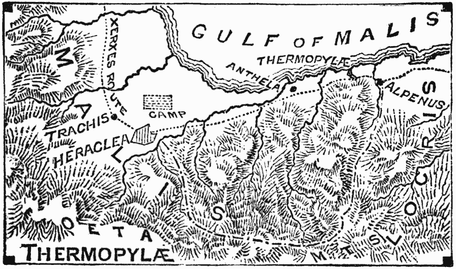
Description: A map of the battle site of Thermopylæ on the Gulf of Malis, Greece, during the Second Persian Invasion, showing the route and camp of Xerxes, the city of Heraclea, the bottleneck of Thermopylæ, and the mountain route to Alpenus allowing Xerxes to flank the Greek position.
Place Names: Greece, Thermopyla
ISO Topic Categories: intelligenceMilitary,
inlandWaters,
oceans,
location
Keywords: Thermopylae, transportation, �physical, kAncientGreece, physical features, roads, intelligenceMilitary,
inlandWaters,
oceans,
location, 480 BC
Source: William Swinton, Outlines of the World's History (New York, NY: Ivison, Blakeman, and Company, 1874) 96
Map Credit: Courtesy the private collection of Roy Winkelman |
|