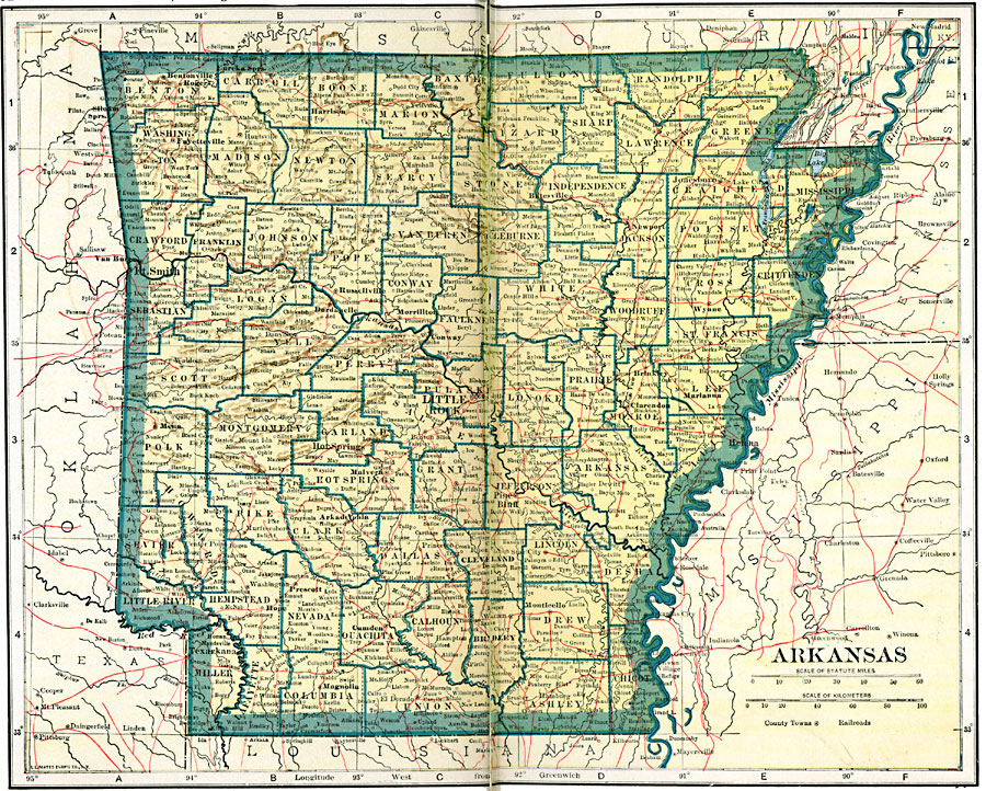
Description: A map of Arkansas from 1919 showing the State capital of Little Rock, counties and county seats, major cities and towns, railroads, mountains, lakes, and rivers.
Place Names: Arkansas, Benton, �Clinton, �Fayetteville, �Fort Smith, �Helena, �Hot Springs, �Jonesboro, �Little Rock, �Pine Bluff, �Texarkan
ISO Topic Categories: oceans,
location,
inlandWaters,
transportation
Keywords: Arkansas, borders, �physical, �railroads, �transportation, �country borders,
county borders, railroads, oceans,
location,
inlandWaters,
transportation, Unknown, 1919
Source: L.L. Poates, Poates Complete Atlas of the World (New York, NY: Poates Corporation , 1921) 32-33
Map Credit: Courtesy the private collection of Roy Winkelman |
|